Coral Sailors Initiative Turns Cruisers Into Reef Surveyors
Marine biologists Tom Puchner and Sonja Napetschnig are training cruisers to film reef transects that can help researchers and local communities track coral health.
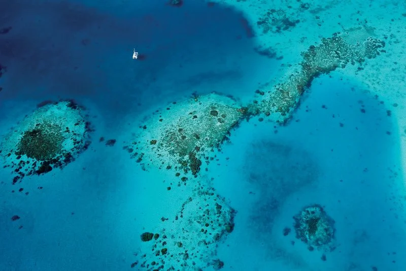
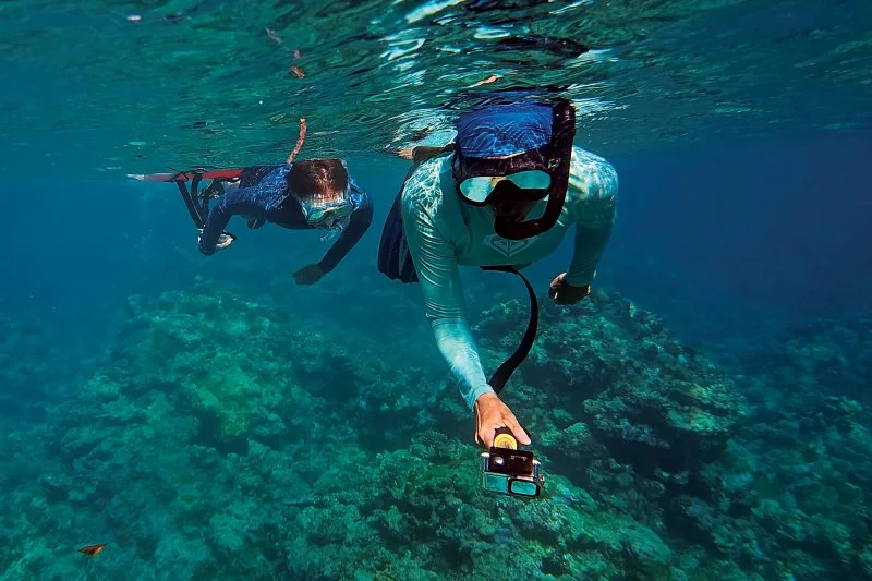
Remote reefs need more consistent observation, and cruising sailors can help fill that gap. Marine biologists Tom Puchner and Sonja Napetschnig created the Coral Sailors Initiative to show cruisers how to film reef surveys in a standardized way, producing footage that researchers can use to study coral habitats.
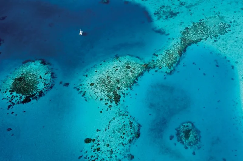
The need is clear in far-flung atolls and archipelagoes, where scientific expeditions can be expensive and difficult to sustain. Local communities may also lack specialized cameras or dependable broadband access. Yet these places can hold reefs that have received little monitoring, leaving scientists with limited information about their condition and changes over time.
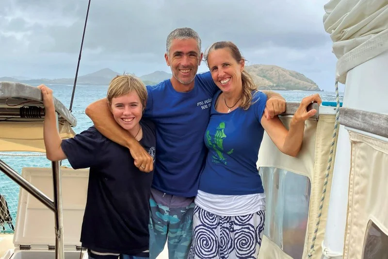
Puchner and Napetschnig saw the problem during more than 13 years sailing tropical seas aboard an all-electric Polynesian double-canoe-style Wharram catamaran. Their cruising routine brought practical demands: boat maintenance, refits, passage planning and homeschooling. They still took part in citizen-science work, including manta ray identification and a small Austrian coral project, and monitored reefs for their own interest. But, as they acknowledge, they had not been able to do as much formal research as they wanted.
From reef watching to repeatable surveys
The turning point came through a project in Gambier, French Polynesia. In 2017, after worldwide mass-bleaching events, the couple began documenting coral reefs there. When they returned in 2018, they could check on individual colonies. Those visits gave them a window into change, but also exposed a limitation: occasional spot-checks weren’t enough to produce scientifically reliable results.
By 2024, they had developed a standardized video transect method. A transect follows a specific path while recording the habitat and organisms along it, allowing observations to be collected systematically. The aim is to build reliable baselines that can support research and local conservation and management work. When other cruisers expressed interest, Puchner and Napetschnig formed the Coral Sailors Initiative to make the approach accessible to more sailors.
The couple’s route to marine research began at the University of Vienna, where both studied marine biology. They later founded the Lošinj Biostation in Croatia to teach high-school students and prepare young people to advocate for ocean conservation. Life afloat was a natural extension of that commitment: they wanted to raise their son, Keanu, close to nature while traveling with a minimal carbon footprint.
Now that Keanu has started online school, the family has more room in its routine for scientific work. That shift matters because useful monitoring calls for more than a camera and a passing visit. A consistent method helps turn a sailor’s observation into footage that scientists can assess and compare.
Survey the reef you find
The initiative’s geographic scope is broad: any place where coral grows, could grow or once grew may be worth documenting. Participants don’t have to seek out a spectacular reef. A survey can show a typical stretch near an anchorage, a particularly diverse area, or a place where struggling coral sits beside healthier growth. The main areas they generally skip are sandy bottoms with only an occasional coral head, since corals need a hard surface to settle on.
The project focuses mainly on snorkel depths because snorkeling is accessible to many cruisers. Scuba divers can also contribute footage from deeper reefs when their skills and equipment allow. The guidance is to work within personal capability; the initiative welcomes different observations without suggesting that contributors should exceed their training.
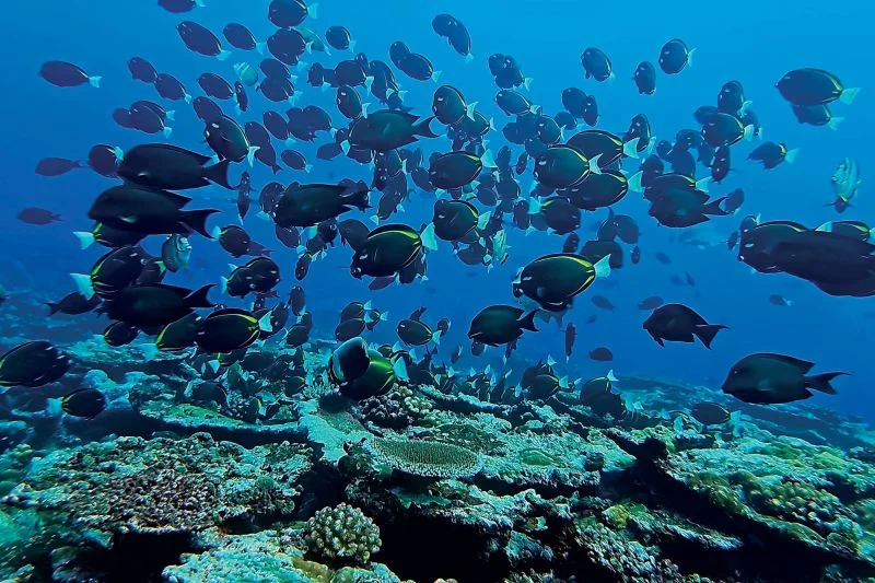
Researchers who cannot visit every isolated atoll could use the footage to study reefs they might otherwise struggle to reach. Local stakeholders may also benefit from better information about the waters they are working to protect. Puchner and Napetschnig say scientists have responded positively to their interactive coral map. They are also establishing a partnership with Corals for Conservation to support restoration work in Fiji.
To encourage more cruisers to take part, the initiative hopes to create an incentive program. Possible options include discounts on camera gear or a small payment for each submitted transect. Those plans depend on securing funding and support from industry, so they remain possibilities rather than confirmed rewards.
Recovery can look different
The couple’s observations resist a simple account of reef decline. They have seen severe damage from bleaching, coastal runoff and destructive fishing, as well as unexpected resilience. Some corals have thrived in murky, warm water near mass tourism. They have also seen striking growth on a lava flow that had been bare rock only a few years earlier. In contrast, some remote reefs with clean water and no fishing pressure show no signs of recovery.
Even a return of coral cover may not mean a return to the same kind of reef. Puchner and Napetschnig describe systems shifting from diverse, colorful habitats to simpler communities dominated by hardier corals. Such reefs remain alive, but may offer a different kind of habitat for fish.
For cruisers, the practical contribution is a repeatable record of the reef encountered on a voyage. A well-made transect can help build a picture across locations and over time, giving scientists and local communities more evidence to work with as they assess changing reefs.
The post The Cruisers Mapping Coral Reefs for Science appeared first on Cruising World.